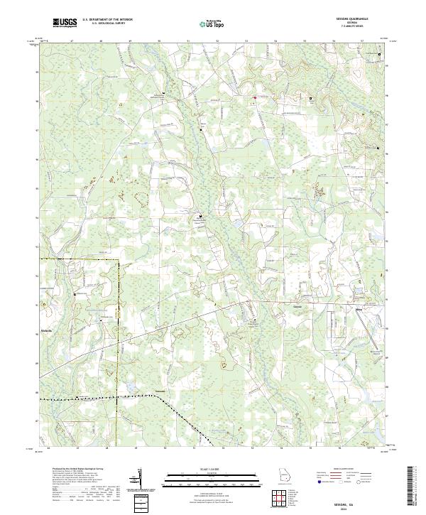
2024 Map of Sessoms
USGS Topo · Published 2024About this map
Little Hurricane Creek and its various tributaries, including Brushy Creek, wind through this rural landscape on the border of Coffee and Bacon counties. The area is defined by a traditional Southern settlement pattern of small, scattered communities like Sessoms, Guysie, and the western edge of Alma. This modern survey reveals the enduring presence of local genealogy sites, with numerous denominational landmarks such as Campground Methodist Church and Douglas Chapel Baptist Church serving as focal points for their respective cemeteries.
Find a feature on this map
130 named features on this map. Tap any name to fly to it.
Don’t see what you’re looking for? This feature index may not catch every label — zoom into the map to look around manually.
Map Details
Editions of this 2024 Sessoms Map
This is the sole edition of this map. No revisions or reprints were ever made.
Other maps of this area

1953 · Waycross
USGS Topo · 1:250,000

1958 · Waycross
USGS Topo · 1:250,000

1971 · Nicholls NE
USGS Topo · 1:24,000

1971 · Nicholls
USGS Topo · 1:24,000

1971 · Wilsonville
USGS Topo · 1:24,000

1971 · Alma NW
USGS Topo · 1:24,000

1971 · Beach
USGS Topo · 1:24,000

1971 · Alma
USGS Topo · 1:24,000

1971 · Sessoms
USGS Topo · 1:24,000

1971 · Denton
USGS Topo · 1:24,000