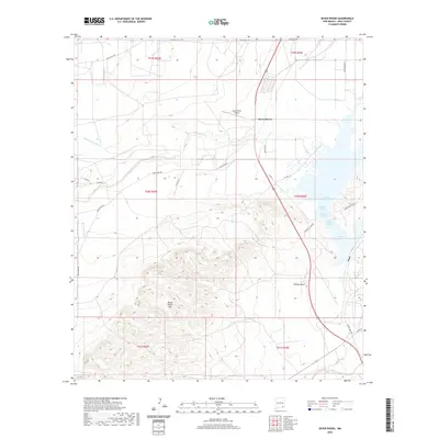
2020 Map of Seven Rivers
USGS Topo · Published 2020About this map
Seven Rivers anchors the northern reaches of this New Mexico landscape, situated where several major desert drainages converge. The map details a complex hydrological environment characterized by numerous natural water sources, including Roaring Spring, Bubbling Spring, and the Twin Boils Spring, all located near the eastern margin. These springs historically supported life in the arid Eddy County basin before the modern infrastructure of the Seven Rivers Airport or the local road network was established. To the south, the topography rises sharply into the Seven Rivers Hills, a prominent area of high relief that contrasts with the drainage basins of Willow Draw and Rocky Arroyo. The intersection of multiple watercourses, such as Middle Seven Rivers and South Seven Rivers, suggests a long history of water management and land use in this specific corner of the Pecos River valley system.
Find a feature on this map
34 named features on this map. Tap any name to fly to it.
Don’t see what you’re looking for? This feature index may not catch every label — zoom into the map to look around manually.
Map Details
Editions of this 2020 Seven Rivers Map
This is the sole edition of this map. No revisions or reprints were ever made.
Other maps of this area

1940 · Bandanna Point
USGS Topo · 1:62,500

1943 · Bandanna Point
USGS Topo · 1:62,500

1943 · West Carlsbad
USGS Topo · 1:62,500

1945 · West Carlsbad
USGS Topo · 1:62,500

1954 · Seven Rivers
USGS Topo · 1:24,000

1954 · Carlsbad
USGS Topo · 1:250,000

1955 · Dayton
USGS Topo · 1:24,000

1955 · Lake Mc Millan North
USGS Topo · 1:24,000

1955 · Lake Mc Millan South
USGS Topo · 1:24,000

1956 · Parish Ranch
USGS Topo · 1:24,000