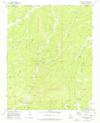
1970 Map of Seven Springs
USGS Topo · Published 1978About this map
Seven Springs serves as a central hub within this high-elevation landscape of the Santa Fe National Forest, where water and forest management define the local activity. The presence of the State Fish Hatchery and Seven Springs Guard Sta along the Rio Cebolla underscores the area's role in conservation and public land stewardship. This 1970s record captures the network of canyons and springs that shaped local recreation and ranching, from the prominent Fenton Lake and Fenton Ranch in the south to the isolated Peñas Negras Cabin in the north.
Find a feature on this map
44 named features on this map. Tap any name to fly to it.
Don’t see what you’re looking for? This feature index may not catch every label — zoom into the map to look around manually.
Map Details
Editions of this 1970 Seven Springs Map
4 editions found

Other maps of this area

1890 · Jemes
USGS Topo · 1:125,000

1892 · Jemes
USGS Topo · 1:125,000

1909 · Gallina
USGS Topo · 1:125,000

1937 · Jemez Springs
USGS Topo · 1:48,000

1939 · La Ventana
USGS Topo · 1:62,500

1940 · Cuba
USGS Topo · 1:62,500

1943 · Cuba
USGS Topo · 1:62,500

1943 · La Ventana
USGS Topo · 1:62,500

1944 · Jemez Springs
USGS Topo · 1:62,500

1952 · Jemez Springs
USGS Topo · 1:62,500