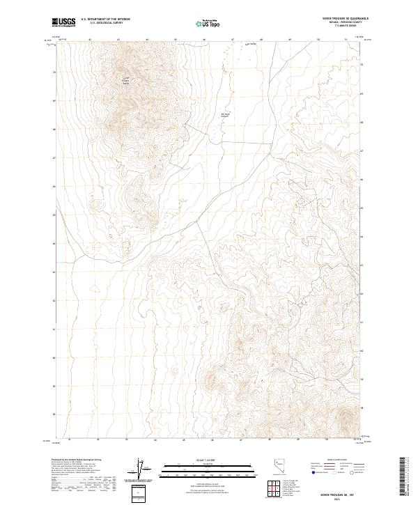
2021 Map of Seven Troughs SE
USGS Topo · Published 2021About this map
The Seven Troughs Range dominates the northwestern corner of this territory, giving way to the open reaches of Sage Valley in the northeast. This high-desert landscape is defined by its dramatic relief and drainage patterns, most notably through Toll Rock Canyon, which cuts a significant path through the arid terrain. The lack of modern development or permanent settlements across these townships emphasizes the isolation of the Great Basin during this era of mapping. Surveyors from the U.S. Geological Survey have documented the intricate contouring of the range, revealing a landscape where water and elevation dictate the few routes through the area, such as the tracks following the natural contours of the valley floors and canyon passes.
Find a feature on this map
7 named features on this map. Tap any name to fly to it.
Don’t see what you’re looking for? This feature index may not catch every label — zoom into the map to look around manually.
Map Details
Editions of this 2021 Seven Troughs SE Map
This is the sole edition of this map. No revisions or reprints were ever made.
Other maps of this area

1931 · Lovelock
USGS Topo · 1:250,000

1935 · Lovelock
USGS Topo · 1:250,000

1955 · Lovelock
USGS Topo · 1:250,000

1956 · Toulon
USGS Topo · 1:62,500

1959 · Lovelock
USGS Topo · 1:250,000
1981 · Bluewing Flat South
USGS Topo · 1:24,000

1981 · Bluewing Flat North
USGS Topo · 1:24,000
1981 · Seven Troughs
USGS Topo · 1:24,000

1981 · Trinity Pass
USGS Topo · 1:24,000
1981 · Trinity Pass NW
USGS Topo · 1:24,000