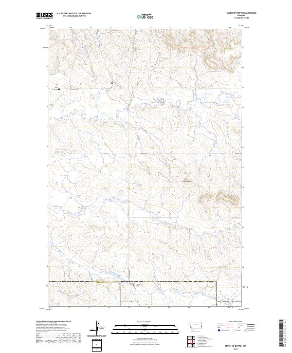
2024 Map of Seven-up Butte
USGS Topo · Published 2024About this map
Lame Jones Cem sits at the northern edge of this high plains landscape, a quiet marker of early settlement along the drainage of Lame Jones Creek. The terrain is defined by the prominent Seven-up Butte, which overlooks a network of intermittent waterways including Milk Creek and its tributary, South Fork Milk Creek. The survey reveals a sparse but deliberate network of section-line roads and named trails, such as Lame Jones Trl and Plevna Rd S, which facilitate transit across the open range. The southern portion of the map documents the administrative boundary between Fallon County and Carter County, illustrating how these remote drainage basins and buttes were partitioned into township and range grids. The concentration of names around the creek valleys suggests these watercourses remained the primary focal points for navigation and land use in this part of eastern Montana.
Find a feature on this map
18 named features on this map. Tap any name to fly to it.
Don’t see what you’re looking for? This feature index may not catch every label — zoom into the map to look around manually.
Map Details
Editions of this 2024 Seven-up Butte Map
This is the sole edition of this map. No revisions or reprints were ever made.
Other maps of this area

1953 · Miles City
USGS Topo · 1:250,000

1957 · Miles City
USGS Topo · 1:250,000

1958 · Miles City
USGS Topo · 1:250,000

1981 · Baker
USGS Topo · 1:100,000

1981 · Harmon Butte
USGS Topo · 1:24,000

1981 · South Sandstone Reservoir
USGS Topo · 1:24,000

1981 · Little Pine Creek
USGS Topo · 1:24,000

1981 · Seven-Up Butte
USGS Topo · 1:24,000
1981 · Sportsman Pond
USGS Topo · 1:24,000
1981 · Medicine Rocks State Park
USGS Topo · 1:24,000