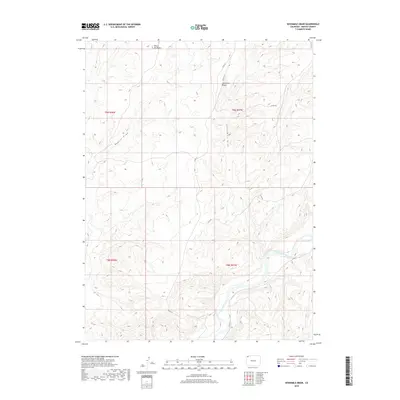
2019 Map of Sevenmile Draw
USGS Topo · Published 2019About this map
Little Snake River winds through the southern portion of this high-country landscape in Moffat County, forming the primary drainage for the surrounding draws and ridges. The topography is defined by the prominent Sevenmile Ridge, which runs north-to-south, separated from western elevations by the deep drainage of Sevenmile Draw. The landscape's character is further marked by the isolated rise of Yellow Cat Butte in the northwest, a distinctive landmark amidst the high-altitude terrain.
Find a feature on this map
14 named features on this map. Tap any name to fly to it.
Don’t see what you’re looking for? This feature index may not catch every label — zoom into the map to look around manually.
Map Details
Editions of this 2019 Sevenmile Draw Map
This is the sole edition of this map. No revisions or reprints were ever made.
Other maps of this area

1954 · Vernal
USGS Topo · 1:250,000

1958 · Vernal
USGS Topo · 1:250,000

1958 · Maybell
USGS Topo · 1:62,500

1960 · Vernal
USGS Topo · 1:250,000

1960 · Lone Mountain
USGS Topo · 1:62,500

1969 · The Nipple
USGS Topo · 1:24,000

1969 · Sheepherder Springs
USGS Topo · 1:24,000
1969 · Lang Spring
USGS Topo · 1:24,000
1979 · Canyon of Lodore
USGS Topo · 1:100,000
1986 · Lone Mountain
USGS Topo · 1:24,000