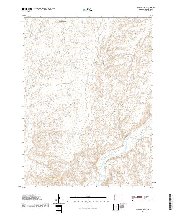
2022 Map of Sevenmile Draw
USGS Topo · Published 2022About this map
The Little Snake River meanders through the southeastern portion of this terrain, defining the local drainage patterns alongside Sevenmile Draw and Dugout Draw. The landscape is dominated by significant topographical markers like Sevenmile Ridge and the prominent Yellow Cat Butte in the north. This 2022 survey illustrates the network of rural infrastructure in Moffat County, including Co RD 75 and Co RD 21, which navigate the various washes and ridges. The presence of Yellow Cat Wash and Sand Wash indicates a high-desert environment where intermittent water flow has carved the land over time. This map serves as a contemporary record of land use and geography in a relatively undeveloped section of Colorado, documenting the essential county road systems that provide access to the remote ridges and river valleys.
Find a feature on this map
15 named features on this map. Tap any name to fly to it.
Don’t see what you’re looking for? This feature index may not catch every label — zoom into the map to look around manually.
Map Details
Editions of this 2022 Sevenmile Draw Map
This is the sole edition of this map. No revisions or reprints were ever made.
Other maps of this area

1954 · Vernal
USGS Topo · 1:250,000

1958 · Vernal
USGS Topo · 1:250,000

1958 · Maybell
USGS Topo · 1:62,500

1960 · Vernal
USGS Topo · 1:250,000

1960 · Lone Mountain
USGS Topo · 1:62,500

1969 · The Nipple
USGS Topo · 1:24,000

1969 · Sheepherder Springs
USGS Topo · 1:24,000
1969 · Lang Spring
USGS Topo · 1:24,000
1979 · Canyon of Lodore
USGS Topo · 1:100,000
1986 · Lone Mountain
USGS Topo · 1:24,000