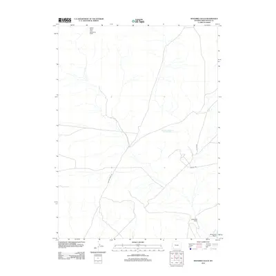
2012 Map of Sevenmile Gulch
USGS Topo · Published 2012About this map
Historic pathways intersect with industrial development in this section of Sweetwater County. The map documents the enduring presence of the Emigrant Trl and the Brigham Young 1847 route, offering a clear record of the overland trails that defined the Western migration era. These traditional corridors are shown alongside modern resource extraction infrastructure, including the Texasgulf Rd and the Texasgulf Emergency Pond Number 2. The landscape is characterized by a network of ephemeral drainages, primarily the Sevenmile Gulch and Sevenmile Wash, which collect at Yellow Point Fork Sevenmile Gulch. This data provides a precise look at how 19th-century pioneer routes persisted into the 21st century, often serving as the foundation for the region's contemporary industrial and service roads.
Find a feature on this map
7 named features on this map. Tap any name to fly to it.
Don’t see what you’re looking for? This feature index may not catch every label — zoom into the map to look around manually.
Map Details
Editions of this 2012 Sevenmile Gulch Map
This is the sole edition of this map. No revisions or reprints were ever made.
Other maps of this area

1954 · Ogden
USGS Topo · 1:250,000

1954 · Rock Springs
USGS Topo · 1:250,000

1958 · Ogden
USGS Topo · 1:250,000

1958 · Rock Springs
USGS Topo · 1:250,000

1960 · Ogden
USGS Topo · 1:250,000

1961 · Blue Point
USGS Topo · 1:24,000

1961 · Little America
USGS Topo · 1:24,000

1961 · Sevenmile Gulch
USGS Topo · 1:24,000

1961 · Granger
USGS Topo · 1:24,000

1962 · Rock Springs
USGS Topo · 1:250,000