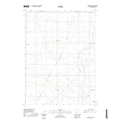
2017 Map of Sevenmile Gulch
USGS Topo · Published 2017About this map
The path of the Brigham Young 1847 route bisects this high desert landscape, marking the historic westward movement through Sweetwater County. This corridor is shared by the Emigrant Trl, where the physical geography of the Sevenmile Gulch and Sevenmile Wash influenced the early travel patterns of pioneers and settlers. These traditional routes persist alongside modern industrial infrastructure, such as Texasgulf Rd and the Texasgulf Emergency Pond Number 2. The map illustrates a landscape defined by its historical transit role, where township and range lines like t20n r111w provide a rigid grid over the undulating natural terrain and the winding tracks of nineteenth-century expeditions.
Find a feature on this map
13 named features on this map. Tap any name to fly to it.
Don’t see what you’re looking for? This feature index may not catch every label — zoom into the map to look around manually.
Map Details
Editions of this 2017 Sevenmile Gulch Map
This is the sole edition of this map. No revisions or reprints were ever made.
Other maps of this area

1954 · Ogden
USGS Topo · 1:250,000

1954 · Rock Springs
USGS Topo · 1:250,000

1958 · Ogden
USGS Topo · 1:250,000

1958 · Rock Springs
USGS Topo · 1:250,000

1960 · Ogden
USGS Topo · 1:250,000

1961 · Blue Point
USGS Topo · 1:24,000

1961 · Little America
USGS Topo · 1:24,000

1961 · Sevenmile Gulch
USGS Topo · 1:24,000

1961 · Granger
USGS Topo · 1:24,000

1962 · Rock Springs
USGS Topo · 1:250,000