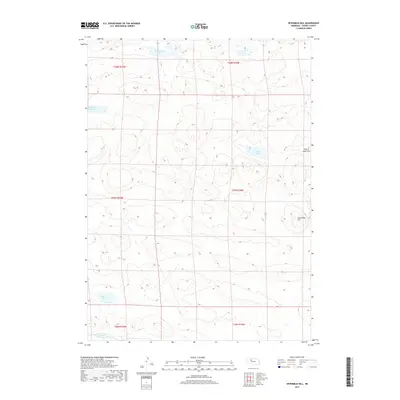
2017 Map of Sevenmile Hill
USGS Topo · Published 2017About this map
Sevenmile Hill rises as a prominent landmark in this segment of the Nebraska Sandhills, overlooking a landscape defined by isolated water bodies and expansive grazing land. This 2017 survey by the U.S. Geological Survey illustrates the sparse settlement patterns of Cherry County, where land use is dictated by the availability of water. Named features such as Roseberry Lake, Speck Lake, and Meir Lake appear as catchments for the region's limited surface water, while the presence of Cox Reservoir Number 1 along Calf Cr suggests the vital role of water management for local ranching operations. The terrain transitions into the broadly level Prairie Dog Flats, highlighting the subtle but significant topographic variations that characterize this high-plains environment. Researchers will find a clear record of township and range divisions, including t27n r34w and t28n r35w, which continue to organize the remote interior of the state.
Find a feature on this map
14 named features on this map. Tap any name to fly to it.
Don’t see what you’re looking for? This feature index may not catch every label — zoom into the map to look around manually.
Map Details
Editions of this 2017 Sevenmile Hill Map
This is the sole edition of this map. No revisions or reprints were ever made.
Other maps of this area

1948 · Mullen
USGS Topo · 1:62,500

1949 · Big Falls
USGS Topo · 1:62,500

1950 · Hire
USGS Topo · 1:62,500

1950 · Wolf Lake
USGS Topo · 1:62,500

1951 · Mullen
USGS Topo · 1:62,500

1951 · Big Falls
USGS Topo · 1:62,500

1951 · Wolf Lake
USGS Topo · 1:62,500

1957 · Valentine
USGS Topo · 1:250,000

1959 · Valentine
USGS Topo · 1:250,000

1985 · Mullen
USGS Topo · 1:100,000