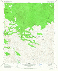
1966 Map of Sevenmile Mts.
USGS Topo · Published 1968About this map
The Sevenmile Mountains dominate the central landscape of this Gila County territory, marking a sharp transition between the Tonto National Forest and the San Carlos Indian Reservation. The mapping reveals a land defined by its water sources, with isolated points like Coffee Pot Well, Gerald Spring, and Pigeon Spring Well serving as vital landmarks for those traversing the high ground. At Sevenmile Camp, the intersection of topography and human activity is evident near the drainage of Sevenmile Wash.
Find a feature on this map
20 named features on this map. Tap any name to fly to it.
Don’t see what you’re looking for? This feature index may not catch every label — zoom into the map to look around manually.
Map Details
Editions of this 1966 Sevenmile Mts. Map
2 editions found
Other maps of this area

1922 · Chrysotile
USGS Topo · 1:125,000

1954 · Mesa
USGS Topo · 1:250,000

1957 · Mesa
USGS Topo · 1:250,000

1958 · Mesa
USGS Topo · 1:250,000

1960 · Mesa
USGS Topo · 1:250,000

1964 · Mesa
USGS Topo · 1:250,000

1966 · Brushy Canyon
USGS Topo · 1:24,000

1966 · Natural Corral
USGS Topo · 1:24,000
1966 · Dourine Canyon
USGS Topo · 1:24,000

1966 · Cassadore Spring
USGS Topo · 1:24,000