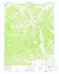
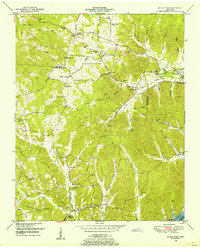
1950 Map of Seventeen Creek
USGS Topo · Published 1975About this map
The boundary between Carroll Co and Benton Co runs through a landscape defined by the deep indentations of the Big Sandy River Drainage Canal and the southern reaches of the Natchez Trace State Park and Forest. This 1950s terrain is heavily wooded, with small settlements like Robison and Smothers appearing as modest clusters of activity amid the ridges. The historical Natchez Trace Road cuts north-south, serving as a primary corridor for rural Tennessee life during this era.
Find a feature on this map
39 named features on this map. Tap any name to fly to it.
Don’t see what you’re looking for? This feature index may not catch every label — zoom into the map to look around manually.
Map Details
Editions of this 1950 Seventeen Creek Map
4 editions found
Other maps of this area

1936 · Yuma
USGS Topo · 1:24,000

1936 · Camden
USGS Topo · 1:24,000

1936 · Seventeen Creek
USGS Topo · 1:24,000

1936 · Vale
USGS Topo · 1:24,000

1936 · Bruceton
USGS Topo · 1:24,000

1936 · Sugar Tree
USGS Topo · 1:24,000

1936 · Cavvia
USGS Topo · 1:24,000

1936 · Buena Vista
USGS Topo · 1:24,000

1936 · Rockport
USGS Topo · 1:24,000
1949 · Sugar Tree
USGS Topo · 1:24,000