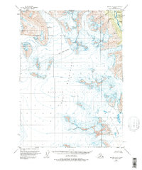
1951 Map of Seward A-8
USGS Topo · Published 1987About this map
The Harding Icefield dominates the southern landscape of this 1951 survey, a glacial expanse punctuated by numerous crevasses that illustrate the dynamic nature of the Kenai Peninsula's interior. This high-altitude wilderness transitions from the frozen plateau into the jagged Kenai Mountains, where the massive Lowell Glacier descends toward the coast. The mapping of the Seward Base Line across this difficult terrain highlights the surveyor's efforts to establish a grid in a region largely defined by ice and rock.
Find a feature on this map
13 named features on this map. Tap any name to fly to it.
Don’t see what you’re looking for? This feature index may not catch every label — zoom into the map to look around manually.
Map Details
Editions of this 1951 Seward A-8 Map
4 editions found

Other maps of this area

1944 · Kenai
USGS Topo · 1:250,000

1946 · Blying Sound
USGS Topo · 1:250,000

1950 · Kenai
USGS Topo · 1:250,000

1950 · Kenai B-1
USGS Topo · 1:63,360

1950 · Seward A-8
USGS Topo · 1:63,360

1950 · Blying Sound D-7
USGS Topo · 1:63,360

1950 · Seward A-7
USGS Topo · 1:63,360

1951 · Blying Sound
USGS Topo · 1:250,000

1951 · Seward
USGS Topo · 1:250,000

1951 · Seldovia
USGS Topo · 1:250,000