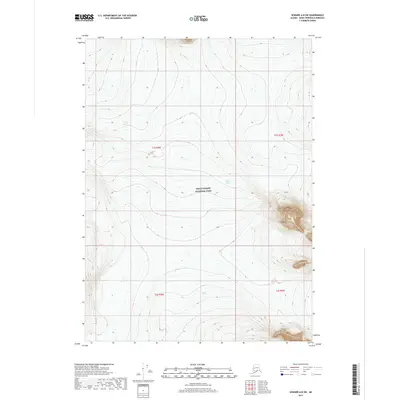
2017 Map of Seward A-8 SW
USGS Topo · Published 2017About this map
Kenai Fjords National Park occupies the central expanse of this 2017 survey, revealing a landscape defined by massive ice fields and high-altitude topography. The map documents the northern reaches of several prominent frozen rivers, including Skilak Glacier in the northwest, the sprawling Bear Glacier near the center, and Aialik Glacier to the south. These glaciers serve as the primary hydrologic drivers for the surrounding region, carving deep valleys between sharp ridgelines. As a modern digital topo, the sheet provides precise elevation data through the park's interior, tracking the ice margins and rocky summits across townships t1s r4w, t1s r3w, t2s r4w, and t2s r3w. This detailed record serves as a vital baseline for observing the glaciated terrain of the Kenai Peninsula in the early twenty-first century.
Find a feature on this map
8 named features on this map. Tap any name to fly to it.
Don’t see what you’re looking for? This feature index may not catch every label — zoom into the map to look around manually.
Map Details
Editions of this 2017 Seward A-8 SW Map
This is the sole edition of this map. No revisions or reprints were ever made.
Other maps of this area

1944 · Kenai
USGS Topo · 1:250,000

1946 · Blying Sound
USGS Topo · 1:250,000

1950 · Kenai
USGS Topo · 1:250,000

1950 · Seward A-8
USGS Topo · 1:63,360

1951 · Blying Sound
USGS Topo · 1:250,000

1951 · Seward
USGS Topo · 1:250,000

1951 · Seldovia
USGS Topo · 1:250,000

1951 · Kenai A-1
USGS Topo · 1:63,360
1951 · Blying Sound D-8
USGS Topo · 1:63,360

1951 · Seward A-8
USGS Topo · 1:63,360