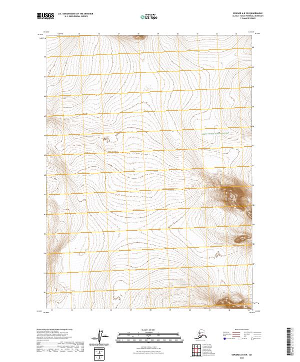
2023 Map of Seward A-8 SW
USGS Topo · Published 2023About this map
Kenai Fjords National Park dominates the eastern landscape of this quadrangle, covering a significant portion of the mountainous terrain within T1s R3w and T2s R3w. The map depicts an area largely defined by its natural topography rather than human settlement, following the Public Land Survey System grids of T1s R4w and T2s R4w. The dense contour lines illustrate the steep elevation changes characteristic of the Kenai Peninsula, providing a detailed record of the glacial and mountainous geography as it exists in the early 21st century. This survey is particularly useful for understanding the exact boundaries of federal protected lands and the undeveloped wilderness adjacent to the park.
Find a feature on this map
5 named features on this map. Tap any name to fly to it.
Don’t see what you’re looking for? This feature index may not catch every label — zoom into the map to look around manually.
Map Details
Editions of this 2023 Seward A-8 SW Map
This is the sole edition of this map. No revisions or reprints were ever made.
Other maps of this area

1944 · Kenai
USGS Topo · 1:250,000

1946 · Blying Sound
USGS Topo · 1:250,000

1950 · Kenai
USGS Topo · 1:250,000

1950 · Seward A-8
USGS Topo · 1:63,360

1951 · Blying Sound
USGS Topo · 1:250,000

1951 · Seward
USGS Topo · 1:250,000

1951 · Seldovia
USGS Topo · 1:250,000

1951 · Kenai A-1
USGS Topo · 1:63,360
1951 · Blying Sound D-8
USGS Topo · 1:63,360

1951 · Seward A-8
USGS Topo · 1:63,360