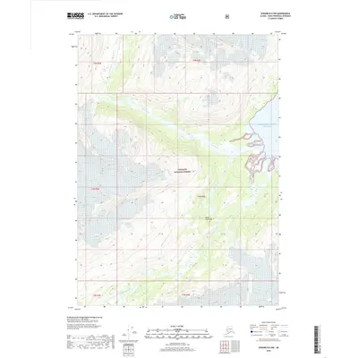
2018 Map of Seward B-5 NW
USGS Topo · Published 2018About this map
Prince William Sound meets the eastern shoreline of the Kenai Peninsula in this 2018 topographic study. The landscape is defined by the massive reach of the Chugach National Forest, where high-altitude glacial features like the Claremont Glacier feed the local drainage systems. The Kings River carves a path through the northern sections, while the Nellie Juan River flows through the southern reaches of the quadrangle. This map documents a largely undeveloped wilderness characterized by steep elevation changes and the complex interaction between glacial ice and coastal waterways. It captures the modern boundaries of national forest land and the precise topographic contours of the coastal range just before the interior mountains.
Find a feature on this map
12 named features on this map. Tap any name to fly to it.
Don’t see what you’re looking for? This feature index may not catch every label — zoom into the map to look around manually.
Map Details
Editions of this 2018 Seward B-5 NW Map
This is the sole edition of this map. No revisions or reprints were ever made.
Other maps of this area

1951 · Seward
USGS Topo · 1:250,000

1951 · Seward C-6
USGS Topo · 1:63,360

1951 · Seward C-5
USGS Topo · 1:63,360

1951 · Seward B-6
USGS Topo · 1:63,360

1951 · Seward B-5
USGS Topo · 1:63,360

1952 · Seward B-6
USGS Topo · 1:63,360

1952 · Seward C-6
USGS Topo · 1:63,360

1952 · Seward C-5
USGS Topo · 1:63,360

1952 · Seward B-5
USGS Topo · 1:63,360

1953 · Seward
USGS Topo · 1:250,000