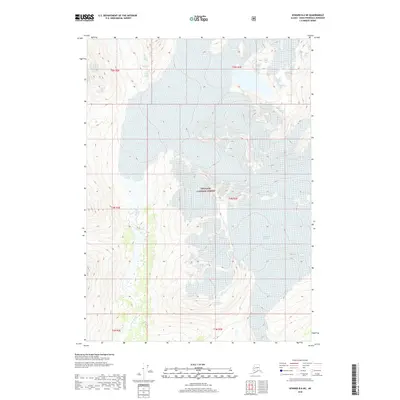
2018 Map of Seward B-6 NE
USGS Topo · Published 2018About this map
Chugach National Forest terrain dominates this 2018 survey, characterized by the expansive ice of Wolverine Glacier and the drainage of the Snow River. Located within the Kenai Peninsula Borough, the map highlights the stark hydrologic relationship between glacial melt and the river systems that carve through the high-elevation topography. The survey provides a clear view of the wilderness before subsequent seasonal changes, documenting the exact contours of the glacier as it existed during the late 2010s. This specific region is defined by its lack of human infrastructure, focusing instead on the natural boundaries of township and range lines across a landscape of ice and stone.
Find a feature on this map
9 named features on this map. Tap any name to fly to it.
Don’t see what you’re looking for? This feature index may not catch every label — zoom into the map to look around manually.
Map Details
Editions of this 2018 Seward B-6 NE Map
This is the sole edition of this map. No revisions or reprints were ever made.
Other maps of this area

1951 · Seward
USGS Topo · 1:250,000

1951 · Seward C-6
USGS Topo · 1:63,360

1951 · Seward C-5
USGS Topo · 1:63,360

1951 · Seward B-6
USGS Topo · 1:63,360

1951 · Seward B-5
USGS Topo · 1:63,360

1952 · Seward B-6
USGS Topo · 1:63,360

1952 · Seward C-6
USGS Topo · 1:63,360

1952 · Seward C-5
USGS Topo · 1:63,360

1952 · Seward B-5
USGS Topo · 1:63,360

1953 · Seward
USGS Topo · 1:250,000