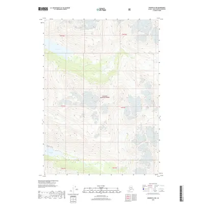
2018 Map of Seward B-6 NW
USGS Topo · Published 2018About this map
The wild and uninhabited terrain of the Chugach National Forest is the primary focus of this Kenai Peninsula study. Two significant alpine water bodies, Grant Lake and Ptarmigan Lake, dominate the high-elevation landscape, joined by a drainage network that includes Grant Creek and Falls Cr. This topographic record provides a detailed look at the drainage patterns of the Kenai Mountains, highlighting the relationship between these glacial lakes and the narrow valley of Grant Cr. Access into these steep, roadless areas is represented by the Ptarmigan Lake Tr, a singular corridor through the wilderness. The lack of settlements or industrial sites emphasizes the protected status of this region, serving as a baseline for the hydrological and geological state of the northern Chugach Range in the early 21st century.
Find a feature on this map
13 named features on this map. Tap any name to fly to it.
Don’t see what you’re looking for? This feature index may not catch every label — zoom into the map to look around manually.
Map Details
Editions of this 2018 Seward B-6 NW Map
This is the sole edition of this map. No revisions or reprints were ever made.
Other maps of this area

1951 · Seward
USGS Topo · 1:250,000

1951 · Seward B-7
USGS Topo · 1:63,360

1951 · Seward C-6
USGS Topo · 1:63,360

1951 · Seward B-6
USGS Topo · 1:63,360

1951 · Seward C-7
USGS Topo · 1:63,360

1952 · Seward B-6
USGS Topo · 1:63,360

1952 · Seward C-6
USGS Topo · 1:63,360

1953 · Seward C-7
USGS Topo · 1:63,360

1953 · Seward B-7
USGS Topo · 1:63,360

1953 · Seward
USGS Topo · 1:250,000