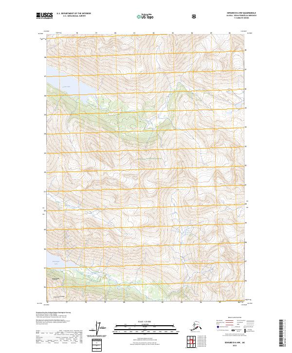
2023 Map of Seward B-6 NW
USGS Topo · Published 2023About this map
Chugach National Forest land defines this portion of the Kenai Peninsula, where high-elevation terrain is bisected by the glacial waters of Grant Lake and Ptarmigan Lake. The settlement at Primrose serves as a small anchor point for access to the backcountry, situated near the head of the Ptarmigan Lake Tr. The landscape is characterized by steep elevation changes, with peaks like Andy Simons Mtn overlooking the drainage of Grant Creek and Falls Creek. This map documents the area as it appeared in 2023, showing the established trail systems and forest boundaries that allow for modern navigation through the peninsula's interior. The relationship between the lake levels and the surrounding mountain ridges highlights the concentrated drainage patterns that feed into the larger regional water systems.
Find a feature on this map
15 named features on this map. Tap any name to fly to it.
Don’t see what you’re looking for? This feature index may not catch every label — zoom into the map to look around manually.
Map Details
Editions of this 2023 Seward B-6 NW Map
This is the sole edition of this map. No revisions or reprints were ever made.
Other maps of this area

1951 · Seward
USGS Topo · 1:250,000

1951 · Seward B-7
USGS Topo · 1:63,360

1951 · Seward C-6
USGS Topo · 1:63,360

1951 · Seward B-6
USGS Topo · 1:63,360

1951 · Seward C-7
USGS Topo · 1:63,360

1952 · Seward B-6
USGS Topo · 1:63,360

1952 · Seward C-6
USGS Topo · 1:63,360

1953 · Seward C-7
USGS Topo · 1:63,360

1953 · Seward B-7
USGS Topo · 1:63,360

1953 · Seward
USGS Topo · 1:250,000