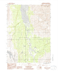
1983 Map of Seward B-7 SE
USGS Topo · Published 1983About this map
Kenai Lake dominates the northern reaches of this Alaskan interior landscape, where the southern shore meets the small settlement of Lakeview. Situated within the Chugach National Forest, the terrain is defined by the massive peaks of Andy Simons Mountain and Sheep Mountain, which overlook the braided channels of the Snow River. This 1983 provisional survey captures a critical corridor of the Kenai Peninsula, showing the relationship between high-altitude alpine lakes and the valley floor settlements.
Find a feature on this map
18 named features on this map. Tap any name to fly to it.
Don’t see what you’re looking for? This feature index may not catch every label — zoom into the map to look around manually.
Map Details
Editions of this 1983 Seward B-7 SE Map
This is the sole edition of this map. No revisions or reprints were ever made.
Other maps of this area

1950 · Seward A-6
USGS Topo · 1:63,360

1950 · Seward A-7
USGS Topo · 1:63,360

1951 · Seward
USGS Topo · 1:250,000

1951 · Seward A-6
USGS Topo · 1:63,360

1951 · Seward A-7
USGS Topo · 1:63,360

1951 · Seward B-7
USGS Topo · 1:63,360

1951 · Seward B-6
USGS Topo · 1:63,360

1952 · Seward B-6
USGS Topo · 1:63,360

1953 · Seward B-7
USGS Topo · 1:63,360

1953 · Seward
USGS Topo · 1:250,000