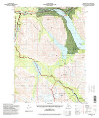
1994 Map of Seward B-8
USGS Topo · Published 1998About this map
Cooper Landing and the northern reach of the Kenai Lake basin serve as the focal point for this wilderness survey. The landscape is defined by the convergence of major waterways, including the Kenai River, Cooper Creek, and Quartz Creek. Human presence is marked by historic roadside stops like Gwins Lodge and Schooner Bend along the Sterling Highway, while the ruins of Russian River Rendezvous hint at earlier eras of habitation and recreation.
Find a feature on this map
58 named features on this map. Tap any name to fly to it.
Don’t see what you’re looking for? This feature index may not catch every label — zoom into the map to look around manually.
Map Details
Editions of this 1994 Seward B-8 Map
This is the sole edition of this map. No revisions or reprints were ever made.
Other maps of this area

1944 · Kenai
USGS Topo · 1:250,000

1950 · Kenai
USGS Topo · 1:250,000

1950 · Kenai B-1
USGS Topo · 1:63,360

1950 · Seward A-8
USGS Topo · 1:63,360

1950 · Seward A-7
USGS Topo · 1:63,360

1951 · Seward
USGS Topo · 1:250,000

1951 · Seward A-7
USGS Topo · 1:63,360

1951 · Kenai C-1
USGS Topo · 1:63,360

1951 · Seward B-7
USGS Topo · 1:63,360

1951 · Kenai A-1
USGS Topo · 1:63,360