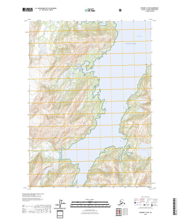
2023 Map of Seward C-4 NW
USGS Topo · Published 2023About this map
Chugach National Forest land meets the Pacific Ocean along a deeply indented coastline of fjords and sheltered inlets. The landscape is defined by the steep, glaciated terrain surrounding Cochrane Bay, where the shoreline transitions sharply from the water to high peaks. Evidence of local navigation and recreational access is found in the 3 Finger - Shrode Lake Trl, which connects the coast to inland water bodies like Lake Shrode. In the northern portion of the map, Surprise Cove offers a protected harbor within this maritime wilderness. The layout of the township and range lines, such as t7n r6e, underscores how the federal Public Land Survey System was applied even to these complex, mountainous coastal regions.
Find a feature on this map
12 named features on this map. Tap any name to fly to it.
Don’t see what you’re looking for? This feature index may not catch every label — zoom into the map to look around manually.
Map Details
Editions of this 2023 Seward C-4 NW Map
This is the sole edition of this map. No revisions or reprints were ever made.
Other maps of this area

1951 · Seward
USGS Topo · 1:250,000

1951 · Seward D-5
USGS Topo · 1:63,360

1951 · Seward C-5
USGS Topo · 1:63,360

1951 · Seward D-4
USGS Topo · 1:63,360

1951 · Seward C-4
USGS Topo · 1:63,360

1952 · Seward D-5
USGS Topo · 1:63,360

1952 · Seward D-4
USGS Topo · 1:63,360

1952 · Seward C-5
USGS Topo · 1:63,360

1952 · Seward C-4
USGS Topo · 1:63,360

1953 · Seward
USGS Topo · 1:250,000