
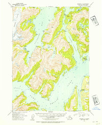
1952 Map of Seward C-4
USGS Topo · Published 1954About this map
Tebenkof Glacier dominates the northwestern terrain of this maritime landscape, feeding into a complex system of fjords and inlets within Prince William Sound. The early 1950s geography is defined by deep water bodies like Cochrane Bay and Port Nellie Juan, which reveal the area's reliance on marine transport and coastal industry. A primary human landmark is the Port Nellie Juan Cannery, situated along the eastern shore of Mc Clure Bay, serving as a focal point for the region's commercial fishing economy during this era. Interior landforms include Lake Shrode and Lake Jack, while the intricate coastline features numerous protected anchorages such as Goose Bay and Surprise Cove. The map also documents significant landmasses including Culross Island and Applegate Island, separated by the navigable Culross Passage.
Find a feature on this map
37 named features on this map. Tap any name to fly to it.
Don’t see what you’re looking for? This feature index may not catch every label — zoom into the map to look around manually.
Map Details
Editions of this 1952 Seward C-4 Map
2 editions found
Other maps of this area

1950 · Seward B-3
USGS Topo · 1:63,360

1951 · Seward
USGS Topo · 1:250,000

1951 · Seward D-5
USGS Topo · 1:63,360

1951 · Seward B-4
USGS Topo · 1:63,360

1951 · Seward C-5
USGS Topo · 1:63,360

1951 · Seward D-4
USGS Topo · 1:63,360

1951 · Seward B-5
USGS Topo · 1:63,360

1951 · Seward D-3
USGS Topo · 1:63,360

1951 · Seward C-4
USGS Topo · 1:63,360

1951 · Seward C-3
USGS Topo · 1:63,360