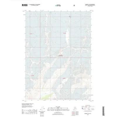
2018 Map of Seward C-5 SW
USGS Topo · Published 2018About this map
Chugach National Forest encompasses this high-elevation region of the Kenai Peninsula, where a complex network of ice fields and flowing glaciers dominates the landscape. The sheer scale of the glaciated terrain is evident in the convergence of massive ice bodies like the Blackstone Glacier and the Northland Glacier, which carve through the steep topography. In the southern portion of the quadrangle, the Spencer Glacier and Trail Glacier define the glacial drainage patterns that feed into the local water systems. This map provides a detailed view of these ice masses as they were recorded in the early 21st century, showing the proximity of the Beloit Glacier and Casement Glacier. The high-relief contours and the course of the Kings River illustrate the dynamic natural processes still shaping this portion of Alaska.
Find a feature on this map
14 named features on this map. Tap any name to fly to it.
Don’t see what you’re looking for? This feature index may not catch every label — zoom into the map to look around manually.
Map Details
Editions of this 2018 Seward C-5 SW Map
This is the sole edition of this map. No revisions or reprints were ever made.
Other maps of this area

1951 · Seward
USGS Topo · 1:250,000

1951 · Seward C-6
USGS Topo · 1:63,360

1951 · Seward C-5
USGS Topo · 1:63,360

1951 · Seward B-6
USGS Topo · 1:63,360

1951 · Seward B-5
USGS Topo · 1:63,360

1952 · Seward B-6
USGS Topo · 1:63,360

1952 · Seward C-6
USGS Topo · 1:63,360

1952 · Seward C-5
USGS Topo · 1:63,360

1952 · Seward B-5
USGS Topo · 1:63,360

1953 · Seward
USGS Topo · 1:250,000