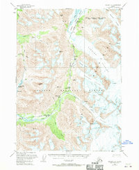
1951 Map of Seward C-6
USGS Topo · Published 1970About this map
The Alaska Railroad carves through the heart of the Kenai Peninsula in this 1951 study, following the valley of the Placer River through the Chugach National Forest. This era of Alaskan transit is defined by engineering feats like the tunnel south of Spencer and the steep grades near Grandview. The landscape is dominated by massive ice fields, including the Spencer Glacier and Bartlett Glacier, which show extensive crevasses as they descend toward the rail line. Small stop points and markers like Hunter and the Soaring Inn provide evidence of the scattered human presence along this vital transportation corridor. High mountain landmarks such as Tincan Peak and Anderson Peak tower over narrow drainage basins like Bertha Creek and Trail Creek, illustrating the complex relationship between the territory's geology and its mid-century infrastructure.
Find a feature on this map
30 named features on this map. Tap any name to fly to it.
Don’t see what you’re looking for? This feature index may not catch every label — zoom into the map to look around manually.
Map Details
Editions of this 1951 Seward C-6 Map
4 editions found
Other maps of this area

1951 · Seward
USGS Topo · 1:250,000

1951 · Seward B-7
USGS Topo · 1:63,360

1951 · Seward C-6
USGS Topo · 1:63,360

1951 · Seward D-5
USGS Topo · 1:63,360

1951 · Seward C-5
USGS Topo · 1:63,360

1951 · Seward B-6
USGS Topo · 1:63,360

1951 · Seward B-5
USGS Topo · 1:63,360

1951 · Seward D-7
USGS Topo · 1:63,360

1951 · Seward C-7
USGS Topo · 1:63,360

1951 · Seward D-6
USGS Topo · 1:63,360