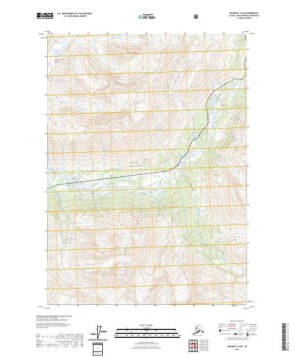
2023 Map of Seward C-6 SW
USGS Topo · Published 2023About this map
Iditarod National Historic Trl winds through the northwestern corner of this mountain landscape, following the high ground near Bench Creek and Bench Lake. Located within the Chugach National Forest, the terrain is defined by dramatic elevations and drainage systems, including the broad braided course of Trail Creek which cuts through the center of the sheet. Notable peaks such as Anderson Peak and the Johnson Creek Summit provide significant landmarks for navigation. To the east, the headwaters of Henry Creek and Moose Creek flow through steep valleys, illustrating the complex hydrology of the Kenai Peninsula. This modern survey captures the drainage patterns and peaks of the region as they were documented in the early twenty-first century.
Find a feature on this map
14 named features on this map. Tap any name to fly to it.
Don’t see what you’re looking for? This feature index may not catch every label — zoom into the map to look around manually.
Map Details
Editions of this 2023 Seward C-6 SW Map
This is the sole edition of this map. No revisions or reprints were ever made.
Other maps of this area

1951 · Seward
USGS Topo · 1:250,000

1951 · Seward B-7
USGS Topo · 1:63,360

1951 · Seward C-6
USGS Topo · 1:63,360

1951 · Seward B-6
USGS Topo · 1:63,360

1951 · Seward C-7
USGS Topo · 1:63,360

1952 · Seward B-6
USGS Topo · 1:63,360

1952 · Seward C-6
USGS Topo · 1:63,360

1953 · Seward C-7
USGS Topo · 1:63,360

1953 · Seward B-7
USGS Topo · 1:63,360

1953 · Seward
USGS Topo · 1:250,000