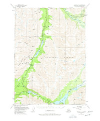
1951 Map of Seward C-7
USGS Topo · Published 1977About this map
Mining activity dominates the high mountain passes of the Chugach National Forest in the early 1950s. The landscape is dotted with hard-rock claims such as the Gilpatrick Mine, Independence Mine, Oracle Mines, and the Mascot Mine, clustered near steep drainages like Colorado Creek and Summit Creek. These operations signify a period of persistent prospecting and extraction in the Kenai Peninsula interior, where the Seward Highway and the Alaska Railroad provided the vital lifelines for machinery and ore transport. Small settlements and waypoints like Dahl, Gilpatricks, and Moose Pass serve as the primary human anchors along the transportation corridor. To the south, the junction of the Sterling Highway near Tern Lake marks a critical node for travel across the peninsula, while recreation sites like Tern Lake Campground and the Granite Creek Recreational Area indicate the early post-war growth of tourism and public land use in the Alaskan wilderness.
Find a feature on this map
64 named features on this map. Tap any name to fly to it.
Don’t see what you’re looking for? This feature index may not catch every label — zoom into the map to look around manually.
Map Details
Editions of this 1951 Seward C-7 Map
2 editions found
Other maps of this area

1951 · Seward
USGS Topo · 1:250,000

1951 · Seward B-7
USGS Topo · 1:63,360

1951 · Seward C-6
USGS Topo · 1:63,360

1951 · Seward B-6
USGS Topo · 1:63,360

1951 · Seward C-8
USGS Topo · 1:63,360

1951 · Seward D-8
USGS Topo · 1:63,360

1951 · Seward D-7
USGS Topo · 1:63,360

1951 · Seward B-8
USGS Topo · 1:63,360

1951 · Seward C-7
USGS Topo · 1:63,360

1951 · Seward D-6
USGS Topo · 1:63,360