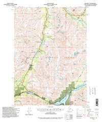
1994 Map of Seward C-7
USGS Topo · Published 1998About this map
Moose Pass sits at the southern junction of the Seward Highway and the Sterling Highway, serving as a vital transportation node in the Chugach Mountains during the 1990s. The landscape is defined by the legacy of resource extraction, with numerous mining sites such as the Dahl Placer Mine, Frenchy Creek Mine, and McMillan Mines dotting the drainages of Mills Creek and Quartz Creek.
Find a feature on this map
86 named features on this map. Tap any name to fly to it.
Don’t see what you’re looking for? This feature index may not catch every label — zoom into the map to look around manually.
Map Details
Editions of this 1994 Seward C-7 Map
This is the sole edition of this map. No revisions or reprints were ever made.
Other maps of this area

1951 · Seward
USGS Topo · 1:250,000

1951 · Seward B-7
USGS Topo · 1:63,360

1951 · Seward C-6
USGS Topo · 1:63,360

1951 · Seward B-6
USGS Topo · 1:63,360

1951 · Seward C-8
USGS Topo · 1:63,360

1951 · Seward D-8
USGS Topo · 1:63,360

1951 · Seward D-7
USGS Topo · 1:63,360

1951 · Seward B-8
USGS Topo · 1:63,360

1951 · Seward C-7
USGS Topo · 1:63,360

1951 · Seward D-6
USGS Topo · 1:63,360