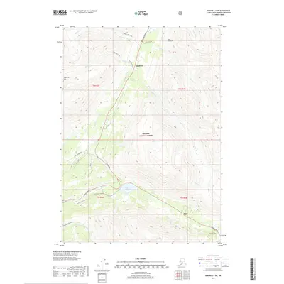
2018 Map of Seward C-7 SW
USGS Topo · Published 2018About this map
Gilpatricks and the northern outskirts of Moose Pass occupy this section of the Kenai Peninsula, where mountain transit corridors converge within the Chugach National Forest. The landscape is defined by the intersection of the Seward Highway and the Sterling Highway, a junction marked by the waters of Tern Lake. This area serves as a primary gateway for those moving between the peninsula's interior and the coast, with several historic routes still visible.
Find a feature on this map
33 named features on this map. Tap any name to fly to it.
Don’t see what you’re looking for? This feature index may not catch every label — zoom into the map to look around manually.
Map Details
Editions of this 2018 Seward C-7 SW Map
This is the sole edition of this map. No revisions or reprints were ever made.
Other maps of this area

1951 · Seward
USGS Topo · 1:250,000

1951 · Seward B-7
USGS Topo · 1:63,360

1951 · Seward C-8
USGS Topo · 1:63,360

1951 · Seward B-8
USGS Topo · 1:63,360

1951 · Seward C-7
USGS Topo · 1:63,360

1952 · Seward C-8
USGS Topo · 1:63,360
1952 · Seward B-8
USGS Topo · 1:63,360

1953 · Seward C-7
USGS Topo · 1:63,360

1953 · Seward B-7
USGS Topo · 1:63,360

1953 · Seward
USGS Topo · 1:250,000