
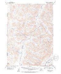
1952 Map of Seward C-8
USGS Topo · Published 1954About this map
The Kenai Mountains dominate this 1952 topographic study, showing the wilderness of the Chugach National Forest before widespread modern development. A network of high-elevation passes and creek drainages defines the landscape, with American Pass serving as a notable divide between the Chickaloon River and American Creek watersheds. The map reveals the early connectivity of the region through the Juneau Creek Trail, which skirts the shores of Juneau Lake and Swan Lake.
Find a feature on this map
34 named features on this map. Tap any name to fly to it.
Don’t see what you’re looking for? This feature index may not catch every label — zoom into the map to look around manually.
Map Details
Editions of this 1952 Seward C-8 Map
2 editions found
Other maps of this area

1944 · Kenai
USGS Topo · 1:250,000

1950 · Kenai
USGS Topo · 1:250,000

1950 · Kenai B-1
USGS Topo · 1:63,360

1951 · Seward
USGS Topo · 1:250,000

1951 · Kenai C-1
USGS Topo · 1:63,360

1951 · Seward B-7
USGS Topo · 1:63,360

1951 · Kenai D-1
USGS Topo · 1:63,360

1951 · Seward C-8
USGS Topo · 1:63,360

1951 · Seward D-8
USGS Topo · 1:63,360

1951 · Seward D-7
USGS Topo · 1:63,360