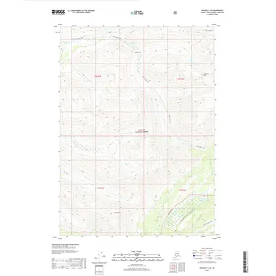
2018 Map of Seward C-8 SE
USGS Topo · Published 2018About this map
Chugach National Forest encompasses this high-elevation landscape in the Kenai Peninsula, where a network of established footpaths serves as the primary infrastructure for traversing the terrain. The Resurrection Pass Trail and Devil's Creek Trail converge near Devils Pass Lake, marking a critical junction for travel between drainages. The topographic detail highlights the prominence of Gilpatrick Mtn and Langille Mtn, which define the local horizon.
Find a feature on this map
23 named features on this map. Tap any name to fly to it.
Don’t see what you’re looking for? This feature index may not catch every label — zoom into the map to look around manually.
Map Details
Editions of this 2018 Seward C-8 SE Map
This is the sole edition of this map. No revisions or reprints were ever made.
Other maps of this area

1951 · Seward
USGS Topo · 1:250,000

1951 · Seward B-7
USGS Topo · 1:63,360

1951 · Seward C-8
USGS Topo · 1:63,360

1951 · Seward B-8
USGS Topo · 1:63,360

1951 · Seward C-7
USGS Topo · 1:63,360

1952 · Seward C-8
USGS Topo · 1:63,360
1952 · Seward B-8
USGS Topo · 1:63,360

1953 · Seward C-7
USGS Topo · 1:63,360

1953 · Seward B-7
USGS Topo · 1:63,360

1953 · Seward
USGS Topo · 1:250,000