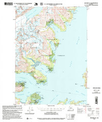
1995 Map of Seward D-4
USGS Topo · Published 1999About this map
The glaciated coastline of Port Wells and Harriman Fiord defines this 1995 revision of a mid-century survey. The map details a landscape where industrial efforts and natural preservation overlap, featuring the Granite Mine near Hobo Bay and the Lansing Mine south of Pigot Bay. Evidence of earlier activity is noted by Ruins near Bettles Bay and a Logging Camp near Passage Canal.
Find a feature on this map
81 named features on this map. Tap any name to fly to it.
Don’t see what you’re looking for? This feature index may not catch every label — zoom into the map to look around manually.
Map Details
Editions of this 1995 Seward D-4 Map
This is the sole edition of this map. No revisions or reprints were ever made.
Other maps of this area

1951 · Seward
USGS Topo · 1:250,000

1951 · Anchorage
USGS Topo · 1:250,000

1951 · Seward D-5
USGS Topo · 1:63,360

1951 · Seward C-5
USGS Topo · 1:63,360

1951 · Seward D-4
USGS Topo · 1:63,360

1951 · Seward D-3
USGS Topo · 1:63,360

1951 · Seward C-4
USGS Topo · 1:63,360

1951 · Seward C-3
USGS Topo · 1:63,360

1952 · Seward D-5
USGS Topo · 1:63,360

1952 · Seward D-3
USGS Topo · 1:63,360