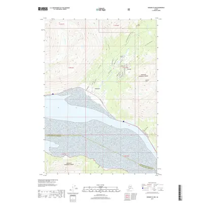
2017 Map of Seward D-6 NW
USGS Topo · Published 2017About this map
Girdwood and the neighboring community of Alyeska serve as the focal points of this Chugach mountain corridor. The landscape is defined by the steep glacial valleys of Glacier Creek and California Creek, which drain toward the tidal flats of the Turnagain Arm. This survey highlights the region's deep connection to historical transportation routes, featuring segments of the Girdwood Iditarod Trail and the Winner Creek Trail as they navigate the elevations around Baumann Bump.
Find a feature on this map
42 named features on this map. Tap any name to fly to it.
Don’t see what you’re looking for? This feature index may not catch every label — zoom into the map to look around manually.
Map Details
Editions of this 2017 Seward D-6 NW Map
This is the sole edition of this map. No revisions or reprints were ever made.
Other maps of this area

1951 · Seward
USGS Topo · 1:250,000

1951 · Anchorage
USGS Topo · 1:250,000

1951 · Seward D-7
USGS Topo · 1:63,360

1951 · Seward D-6
USGS Topo · 1:63,360

1952 · Seward D-6
USGS Topo · 1:63,360

1952 · Seward D-7
USGS Topo · 1:63,360

1953 · Seward
USGS Topo · 1:250,000

1959 · Seward
USGS Topo · 1:250,000

1960 · Anchorage A-6
USGS Topo · 1:63,360

1960 · Anchorage A-7
USGS Topo · 1:63,360