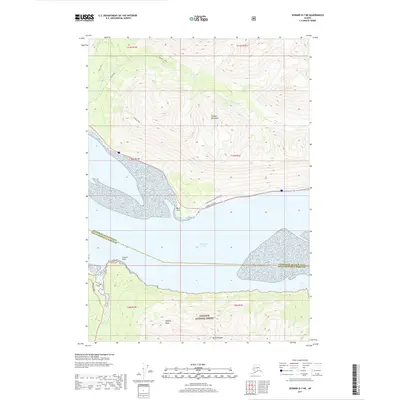
2017 Map of Seward D-7 NE
USGS Topo · Published 2017About this map
Turnagain Arm cuts through the center of this terrain, separating the northern coastal stretches of the Chugach National Forest from the dramatic heights of the Chugach Mountains above. Along the northern shore, the Seward Highway follows the narrow bench between the tidal flats and the steep ascent toward Penguin Peak. To the south, the landscape is marked by the historical presence of the Sunrise Cem near the mouth of Sixmile Creek, a small signifier of the area's gold-rush era settlement at the junction with the Hope Highway. The map details a transit corridor defined by the Girdwood to Indian Bike Path and prominent landforms like Bird Point and Snipers Point. High peaks such as Bradley Peak and Mt Alpenglow dominate the interior, where numerous drainages like Penguin Cr and Bird Cr carve through deep valleys toward the sea.
Find a feature on this map
26 named features on this map. Tap any name to fly to it.
Don’t see what you’re looking for? This feature index may not catch every label — zoom into the map to look around manually.
Map Details
Editions of this 2017 Seward D-7 NE Map
This is the sole edition of this map. No revisions or reprints were ever made.
Other maps of this area

1951 · Seward
USGS Topo · 1:250,000

1951 · Anchorage
USGS Topo · 1:250,000

1951 · Seward D-7
USGS Topo · 1:63,360

1951 · Seward D-6
USGS Topo · 1:63,360

1952 · Seward D-6
USGS Topo · 1:63,360

1952 · Seward D-7
USGS Topo · 1:63,360

1953 · Seward
USGS Topo · 1:250,000

1959 · Seward
USGS Topo · 1:250,000

1960 · Anchorage A-6
USGS Topo · 1:63,360

1960 · Anchorage A-7
USGS Topo · 1:63,360