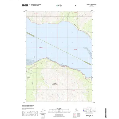
2018 Map of Seward D-7 NW
USGS Topo · Published 2018About this map
Turnagain Arm dominates this geography, separating the northern municipal boundary from the southern reaches of the Chugach National Forest. On the northern shore, the Seward Highway and the Girdwood to Indian Bike Path follow the tight corridor between the water and the rising slopes of Bird Ridge. Significant local infrastructure is noted, including Powerline Road and the Old Johns Road (Boretide) near the mouth of Indian Cr. To the south, the community around Hope Highway is centered near the Hope Airport and the drainage of Bear Cr. This survey illustrates the vital transportation links required to navigate the coastal terrain, from established roads like Palmer Creek Rd to the interior Bear Creek Trail which heads south toward the higher peaks.
Find a feature on this map
26 named features on this map. Tap any name to fly to it.
Don’t see what you’re looking for? This feature index may not catch every label — zoom into the map to look around manually.
Map Details
Editions of this 2018 Seward D-7 NW Map
This is the sole edition of this map. No revisions or reprints were ever made.
Other maps of this area

1951 · Seward
USGS Topo · 1:250,000

1951 · Anchorage
USGS Topo · 1:250,000

1951 · Seward D-8
USGS Topo · 1:63,360

1951 · Seward D-7
USGS Topo · 1:63,360

1952 · Seward D-8
USGS Topo · 1:63,360

1952 · Seward D-7
USGS Topo · 1:63,360

1952 · Anchorage A-8
USGS Topo · 1:63,360

1953 · Anchorage A-8
USGS Topo · 1:63,360

1953 · Seward
USGS Topo · 1:250,000

1959 · Seward
USGS Topo · 1:250,000