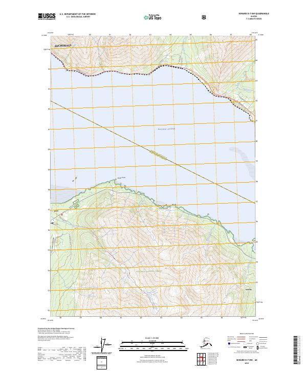
2023 Map of Seward D-7 NW
USGS Topo · Published 2023About this map
The waters of Turnagain Arm separate the southern reaches of Anchorage from the historic mining settlements on the Kenai Peninsula. On the southern shore, the community of Hope is mapped in detail, showing its proximity to the Hope Airport and the Hope Cem. The landscape is dominated by the steep ascent into the Chugach National Forest, where trails such as the Bird Creek Trl and Falls Creek Trl navigate the sharp topography. The transport network reflects the region's reliance on the Seward Highway and Hope Highway for coastal access. To the east, the settlement of Sunrise sits near the mouth of Sunrise Creek, illustrating the scattered nature of these mountain-shadowed outposts. The map also traces the Anchorage Municipality Kenai Peninsula Borough boundary as it cuts across the Pacific Ocean waters.
Find a feature on this map
39 named features on this map. Tap any name to fly to it.
Don’t see what you’re looking for? This feature index may not catch every label — zoom into the map to look around manually.
Map Details
Editions of this 2023 Seward D-7 NW Map
This is the sole edition of this map. No revisions or reprints were ever made.
Other maps of this area

1951 · Seward
USGS Topo · 1:250,000

1951 · Anchorage
USGS Topo · 1:250,000

1951 · Seward D-8
USGS Topo · 1:63,360

1951 · Seward D-7
USGS Topo · 1:63,360

1952 · Seward D-8
USGS Topo · 1:63,360

1952 · Seward D-7
USGS Topo · 1:63,360

1952 · Anchorage A-8
USGS Topo · 1:63,360

1953 · Anchorage A-8
USGS Topo · 1:63,360

1953 · Seward
USGS Topo · 1:250,000

1959 · Seward
USGS Topo · 1:250,000