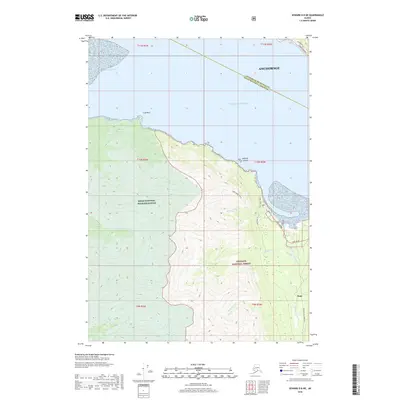
2018 Map of Seward D-8 NE
USGS Topo · Published 2018About this map
The coastal settlement of Hope anchors this survey of the northern Kenai Peninsula where the Resurrection Creek valley meets the tidal waters of Turnagain Arm. The landscape is defined by the intersection of the Kenai National Wildlife Refuge and the Chugach National Forest, illustrating a wilderness managed for both conservation and public access. Transportation is confined to the narrow corridors of the Hope Highway and Resurrection Creek Rd, which provide the primary links for this gold-rush era community.
Find a feature on this map
29 named features on this map. Tap any name to fly to it.
Don’t see what you’re looking for? This feature index may not catch every label — zoom into the map to look around manually.
Map Details
Editions of this 2018 Seward D-8 NE Map
This is the sole edition of this map. No revisions or reprints were ever made.
Other maps of this area

1951 · Seward
USGS Topo · 1:250,000

1951 · Anchorage
USGS Topo · 1:250,000

1951 · Seward D-8
USGS Topo · 1:63,360

1951 · Seward D-7
USGS Topo · 1:63,360

1952 · Seward D-8
USGS Topo · 1:63,360

1952 · Seward D-7
USGS Topo · 1:63,360

1952 · Anchorage A-8
USGS Topo · 1:63,360

1953 · Anchorage A-8
USGS Topo · 1:63,360

1953 · Seward
USGS Topo · 1:250,000

1959 · Seward
USGS Topo · 1:250,000