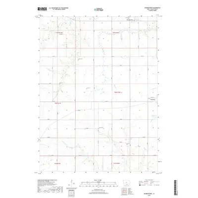
2018 Map of Seymour West
USGS Topo · Published 2018About this map
Seymour and Promise City anchor the corners of this Wayne County landscape, where the rolling divide between the Missouri and Mississippi River watersheds is evident in the diverging flows of Locust Cr and Walnut Cr. The area is characterized by a high density of rural cemeteries, including Bollman Cem, Ripper Cem, Sharp Cem, and Hickerson Cem, which serve as quiet markers of the region's agricultural settlement history. South of the main town, the Seymour City Reservoir provides a critical water resource for the community, while numerous smaller drainages like Jackson Cr and Shoal Cr carve intricate paths through the township sections. Several smaller named nodes such as Granger, Garden, and Filimore appear alongside the section-line roads, reflecting the established grid of 19th-century land divisions that continues to define this corner of southern Iowa into the early 21st century.
Find a feature on this map
33 named features on this map. Tap any name to fly to it.
Don’t see what you’re looking for? This feature index may not catch every label — zoom into the map to look around manually.
Map Details
Editions of this 2018 Seymour West Map
This is the sole edition of this map. No revisions or reprints were ever made.
Other maps of this area

1934 · Humeston
USGS Topo · 1:48,000

1935 · Russell
USGS Topo · 1:62,500

1937 · Corydon
USGS Topo · 1:62,500

1938 · Russell
USGS Topo · 1:62,500

1942 · Seymour
USGS Topo · 1:62,500

1944 · Seymour
USGS Topo · 1:62,500

1954 · Centerville
USGS Topo · 1:250,000

1957 · Centerville
USGS Topo · 1:250,000

1958 · Centerville
USGS Topo · 1:250,000

1964 · Allerton
USGS Topo · 1:24,000