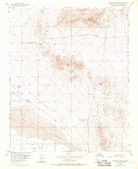
1955 Map of Shadow Mountains
USGS Topo · Published 1969About this map
Shadow Mountains dominate the northern landscape of this Mojave Desert region, where mining operations and isolated ranching outposts defined the local economy during the mid-twentieth century. Resource extraction is evident through numerous prospects, shafts, and tunnels, including the Rabbit Hole Mine and the Princess Pat Mine near Silver Peak. To the south, the terrain descends into the El Mirage Valley, a vast arid basin characterized by the expansive El Mirage Lake bed and the adjacent El Mirage Field. This aviation site, accompanied by an Airway Beacon, underscores the importance of the flat lakebed for early desert flight operations.
Find a feature on this map
25 named features on this map. Tap any name to fly to it.
Don’t see what you’re looking for? This feature index may not catch every label — zoom into the map to look around manually.
Map Details
Editions of this 1955 Shadow Mountains Map
4 editions found
Other maps of this area

1930 · El Mirage
USGS Topo · 1:24,000

1931 · Adobe
USGS Topo · 1:24,000

1932 · Barstow
USGS Topo · 1:125,000

1933 · El Mirage
USGS Topo · 1:24,000

1934 · Barstow
USGS Topo · 1:125,000

1934 · Adobe
USGS Topo · 1:24,000

1937 · Shadow Mountains
USGS Topo · 1:48,000

1937 · Kramer
USGS Topo · 1:48,000

1942 · Kramer
USGS Topo · 1:62,500

1942 · Shadow Mountains
USGS Topo · 1:62,500