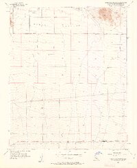
1955 Map of Shadow Mountains SE
USGS Topo · Published 1963About this map
El Mirage Field occupies the high desert floor of El Mirage Valley, marking a landscape defined by aviation and early infrastructure in the mid-1950s. The northern reaches are dominated by the broad expanse of El Mirage Lake, a dry bed serving as a natural focal point for the region. To the east, the rising elevations of the Shadow Mtns break the flat horizon, while Gray Mtn anchors the western edge of the survey.
Find a feature on this map
14 named features on this map. Tap any name to fly to it.
Don’t see what you’re looking for? This feature index may not catch every label — zoom into the map to look around manually.
Map Details
Editions of this 1955 Shadow Mountains SE Map
4 editions found
Other maps of this area

1901 · Southern California Sheet No. 1
USGS Topo · 1:250,000

1902 · Hesperia
USGS Topo · 1:62,500

1903 · San Antonio
USGS Topo · 1:62,500

1904 · Southern California Sheet No. 1
USGS Topo · 1:250,000

1930 · El Mirage
USGS Topo · 1:24,000

1930 · Angle
USGS Topo · 1:24,000

1932 · Angle
USGS Topo · 1:24,000

1932 · Barstow
USGS Topo · 1:125,000

1933 · El Mirage
USGS Topo · 1:24,000

1934 · Barstow
USGS Topo · 1:125,000