
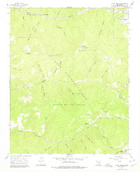
1965 Map of Shady Brook
USGS Topo · Published 1968About this map
Rio Fernando de Taos winds through the northern portion of this landscape, paralleled by Us 64, providing the primary corridor for settlement in this high-altitude region. The map captures the small community of Shady Brook and the mountain retreat of Valle Escondido during a period of mid-century development. Most of the terrain is defined by the Carson National Forest and the Rancho del Rio Grande land grant, where dozens of named canyons such as Buena Suerte Canyon and Mexican Canyon carve through the Fernando Mountains.
Find a feature on this map
44 named features on this map. Tap any name to fly to it.
Don’t see what you’re looking for? This feature index may not catch every label — zoom into the map to look around manually.
Map Details
Editions of this 1965 Shady Brook Map
2 editions found
Other maps of this area

1954 · Raton
USGS Topo · 1:250,000

1958 · Raton
USGS Topo · 1:250,000

1964 · Taos
USGS Topo · 1:24,000

1964 · Tres Ritos
USGS Topo · 1:24,000

1964 · Ranchos De Taos
USGS Topo · 1:24,000

1965 · Osha Mountain
USGS Topo · 1:24,000

1965 · Chacon
USGS Topo · 1:24,000

1965 · Palo Flechado Pass
USGS Topo · 1:24,000

1965 · Pueblo Peak
USGS Topo · 1:24,000
1965 · Cerro Vista
USGS Topo · 1:24,000