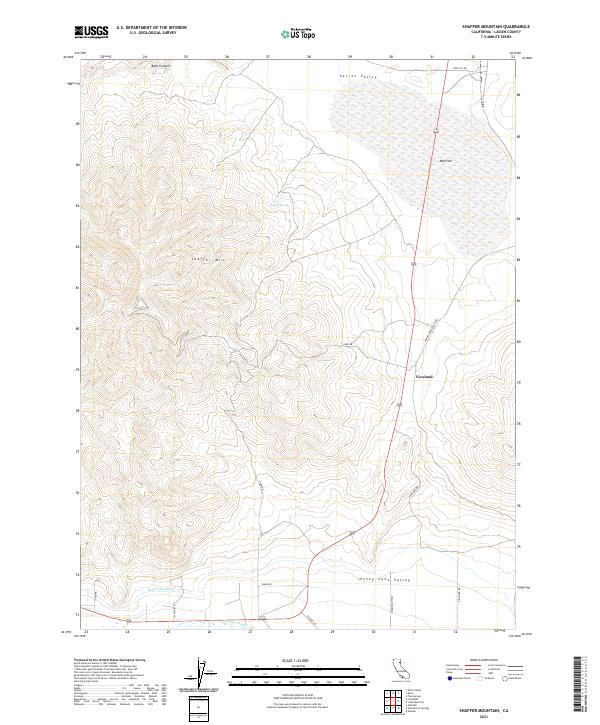
2021 Map of Shaffer Mountain
USGS Topo · Published 2021About this map
Shaffer Mtn dominates this portion of Lassen County, where the high desert terrain transitions between the expansive Secret Valley to the north and the Honey Lake Valley to the south. The small settlement of Viewland sits along the roadway, serving as a landmark in a landscape defined by seasonal water features and irrigation infrastructure. Hydrological patterns are evident in the presence of Mud Flat and Gilman Spring, while the Eagle Lake Ditch and Tanner Slough indicate the historical management of water for local agriculture and ranching. The road network, including Smoke Creek Ranch Rd and Wendel Rd, connects isolated ranching interests across the sagebrush-covered basins and volcanic uplands typical of the northeastern California plateau.
Find a feature on this map
22 named features on this map. Tap any name to fly to it.
Don’t see what you’re looking for? This feature index may not catch every label — zoom into the map to look around manually.
Map Details
Editions of this 2021 Shaffer Mountain Map
This is the sole edition of this map. No revisions or reprints were ever made.
Other maps of this area

1886 · Honey Lake
USGS Topo · 1:250,000

1891 · Honey Lake
USGS Topo · 1:250,000

1893 · Honey Lake
USGS Topo · 1:250,000

1954 · Wendel
USGS Topo · 1:62,500

1954 · Litchfield
USGS Topo · 1:62,500

1954 · Karlo
USGS Topo · 1:62,500

1954 · Shinn Mountain
USGS Topo · 1:62,500

1955 · Westwood
USGS Topo · 1:250,000

1958 · Westwood
USGS Topo · 1:250,000

1959 · Westwood
USGS Topo · 1:250,000