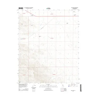
2015 Map of Shale Point
USGS Topo · Published 2015About this map
The Temblor Range dominates the southwestern portion of this landscape, its steep contours giving way to the prominent Shale Point and the adjacent Shale Hills. This transition from high ground to the lower elevations of the Antelope Valley and Antelope Plain illustrates the complex topography of western Kern County. Water sources are sparse but notable, including Alex Cook Spring and Napoleon Spring, which likely served as critical landmarks for early travelers and livestock. The area is defined by its deep drainages, such as Bitterwater Cr and Devilwater Cr, which carve through the Bitterwater Valley. The presence of Bitterwater Valley Rd provides the primary corridor through this otherwise remote region, connecting the elevated ranges to the eastern reaches of the San Joaquin Valley.
Find a feature on this map
20 named features on this map. Tap any name to fly to it.
Don’t see what you’re looking for? This feature index may not catch every label — zoom into the map to look around manually.
Map Details
Editions of this 2015 Shale Point Map
This is the sole edition of this map. No revisions or reprints were ever made.
Other maps of this area

1912 · McKittrick
USGS Topo · 1:125,000

1914 · Lost Hills
USGS Topo · 1:125,000

1914 · Cholame
USGS Topo · 1:125,000

1915 · Cholame
USGS Topo · 1:125,000

1917 · Cholame
USGS Topo · 1:125,000

1932 · Antelope Plain
USGS Topo · 1:31,680

1932 · La Panza
USGS Topo · 1:48,000

1935 · La Panza
USGS Topo · 1:62,500
1936 · Antelope Plain
USGS Topo · 1:31,680

1936 · La Panza
USGS Topo · 1:62,500