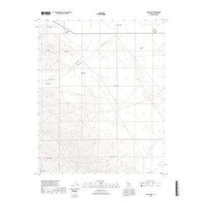
2018 Map of Shale Point
USGS Topo · Published 2018About this map
Temblor Range peaks define the southwestern horizon of this western Kern County landscape, where the terrain descends sharply toward the Bitterwater Valley and the vast Antelope Plain. This area is characterized by ephemeral drainage patterns, with seasonal flows such as Bitterwater Cr and Devilwater Cr carving paths through the arid hills. Named landmarks like Shale Point and the Shale Hills provide essential orientation in a region largely defined by its geological structure and ranching history.
Find a feature on this map
20 named features on this map. Tap any name to fly to it.
Don’t see what you’re looking for? This feature index may not catch every label — zoom into the map to look around manually.
Map Details
Editions of this 2018 Shale Point Map
This is the sole edition of this map. No revisions or reprints were ever made.
Other maps of this area

1912 · McKittrick
USGS Topo · 1:125,000

1914 · Lost Hills
USGS Topo · 1:125,000

1914 · Cholame
USGS Topo · 1:125,000

1915 · Cholame
USGS Topo · 1:125,000

1917 · Cholame
USGS Topo · 1:125,000

1932 · Antelope Plain
USGS Topo · 1:31,680

1932 · La Panza
USGS Topo · 1:48,000

1935 · La Panza
USGS Topo · 1:62,500
1936 · Antelope Plain
USGS Topo · 1:31,680

1936 · La Panza
USGS Topo · 1:62,500