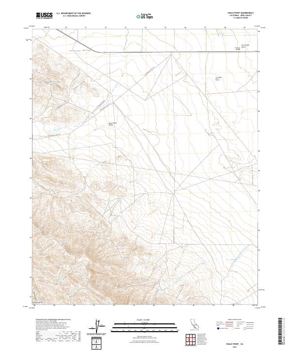
2021 Map of Shale Point
USGS Topo · Published 2021About this map
Alex Cook Spring and Napoleon Spring mark critical water points in the arid transition between the Temblor Range and the western edge of the San Joaquin Valley. This landscape is defined by its geological markers, from the eponymous Shale Point to the elevated ridges of the Shale Hills. The drainage pattern is characterized by seasonal watercourses like Media Agua Cr and Devilwater Cr, which descend toward the Antelope Plain. Human movement through this remote part of Kern County follows Bitterwater Valley Rd, skirting the wide expanse of Bitterwater Valley. The map illustrates the stark geography where the coastal ranges meet the expansive Central Valley floor, showing a territory primarily organized by the Public Land Survey System grids rather than dense settlement.
Find a feature on this map
22 named features on this map. Tap any name to fly to it.
Don’t see what you’re looking for? This feature index may not catch every label — zoom into the map to look around manually.
Map Details
Editions of this 2021 Shale Point Map
This is the sole edition of this map. No revisions or reprints were ever made.
Other maps of this area

1912 · McKittrick
USGS Topo · 1:125,000

1914 · Lost Hills
USGS Topo · 1:125,000

1914 · Cholame
USGS Topo · 1:125,000

1915 · Cholame
USGS Topo · 1:125,000

1917 · Cholame
USGS Topo · 1:125,000

1932 · Antelope Plain
USGS Topo · 1:31,680

1932 · La Panza
USGS Topo · 1:48,000

1935 · La Panza
USGS Topo · 1:62,500
1936 · Antelope Plain
USGS Topo · 1:31,680

1936 · La Panza
USGS Topo · 1:62,500