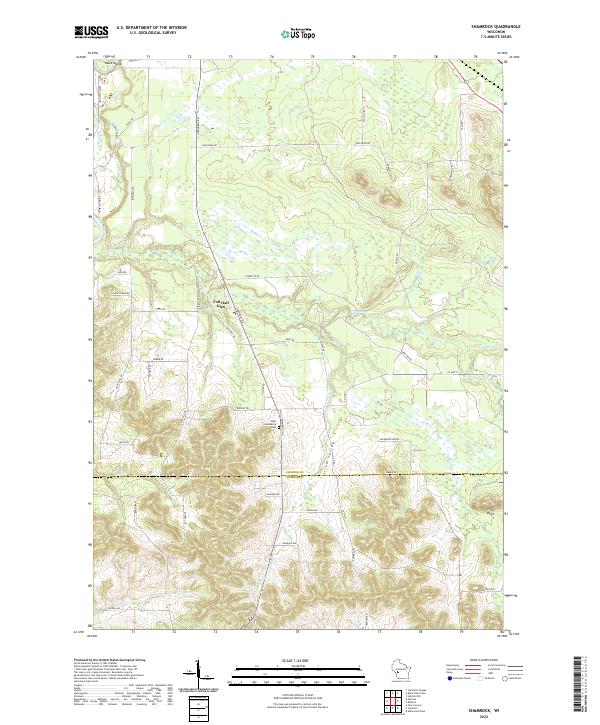
2022 Map of Shamrock
USGS Topo · Published 2022About this map
Fall Hall Glen and the rugged contours of the Jackson Co and Monroe Co border define this landscape in the early 2020s. The area is characterized by its complex hydrology, where Robinson Creek and its various tributaries, including Shamrock Creek and Stony Creek, carve through the terrain. Notable landmarks such as Polly Falls and the prominent Stony Bluff reflect the natural elevation changes that dominate the southern half of the sheet. Local history and genealogy are centered around sites like Saint Columbkille Cem and the settlement of Hawk Island in the northwest. The map captures a transition from the wetland systems near Printz Creek to the more dramatic topography of Irish Valley, providing a detailed look at the rural road network including Oak Ridge Rd and Fall Hall Rd that connects these disparate geographic features.
Find a feature on this map
60 named features on this map. Tap any name to fly to it.
Don’t see what you’re looking for? This feature index may not catch every label — zoom into the map to look around manually.
Map Details
Editions of this 2022 Shamrock Map
This is the sole edition of this map. No revisions or reprints were ever made.
Other maps of this area

1924 · Black River Falls
USGS Topo · 1:62,500

1926 · Black River Falls
USGS Topo · 1:62,500

1928 · Melrose
USGS Topo · 1:48,000

1947 · Millston
USGS Topo · 1:62,500

1949 · Millston
USGS Topo · 1:62,500

1949 · Melrose
USGS Topo · 1:62,500

1953 · Eau Claire
USGS Topo · 1:250,000

1958 · Eau Claire
USGS Topo · 1:250,000

1958 · Hatfield
USGS Topo · 1:48,000

1964 · Eau Claire
USGS Topo · 1:250,000