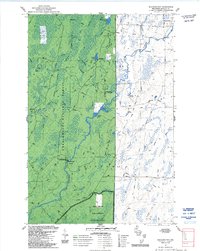
1984 Map of Shanagolden
USGS Topo · Published 1992About this map
The settlement of Shanagolden and the surrounding woodlands of the Chequamegon National Forest define this 1980s-era landscape. This survey reveals a region shaped by its hydrology, where the Chippewa River and the East Fork Chippewa River meander through marshes and dense forest. The map documents the specific land management of the era, including the Spring Brook Semi-Primitive Non Motorized Area, highlighting a period of intentional conservation and recreational use.
Find a feature on this map
28 named features on this map. Tap any name to fly to it.
Don’t see what you’re looking for? This feature index may not catch every label — zoom into the map to look around manually.
Map Details
Editions of this 1984 Shanagolden Map
2 editions found
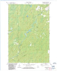
Other maps of this area

1941 · Kennedy
USGS Topo · 1:48,000

1942 · Glidden
USGS Topo · 1:48,000

1942 · Clam Lake
USGS Topo · 1:48,000

1944 · Draper
USGS Topo · 1:48,000

1945 · Kennedy
USGS Topo · 1:48,000

1945 · Clam Lake
USGS Topo · 1:48,000

1945 · Glidden
USGS Topo · 1:48,000

1947 · Draper
USGS Topo · 1:48,000

1953 · Ashland
USGS Topo · 1:250,000

1953 · Rice Lake
USGS Topo · 1:250,000