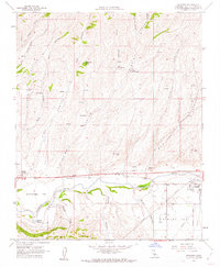
1961 Map of Shandon
USGS Topo · Published 1962About this map
The Estrella River meanders through the central valley of this 1961 survey, carving a path through the alluvial plains of Gruenhagen Flat and Shandon Flat. The settlement of Shandon serves as the local hub, featuring a Fire Control Station and Clark Memorial Park, while Whitley Gardens sits to the west. This area of San Luis Obispo County is defined by a dense network of drainage systems, including Shimmin Canyon, McMillan Canyon, and Pine Canyon, many of which were historically punctuated by vital water sources like Morgenson Springs and Lyon Spring.
Find a feature on this map
40 named features on this map. Tap any name to fly to it.
Don’t see what you’re looking for? This feature index may not catch every label — zoom into the map to look around manually.
Map Details
Editions of this 1961 Shandon Map
3 editions found
Other maps of this area

1914 · Cholame
USGS Topo · 1:125,000

1915 · Cholame
USGS Topo · 1:125,000

1917 · Cholame
USGS Topo · 1:125,000

1919 · San Miguel
USGS Topo · 1:62,500

1919 · Paso Robles
USGS Topo · 1:62,500

1943 · Shandon
USGS Topo · 1:31,680

1943 · Paso Robles
USGS Topo · 1:62,500

1943 · Commatti Canyon
USGS Topo · 1:31,680
1943 · Cholame
USGS Topo · 1:31,680

1943 · Shedd Canyon
USGS Topo · 1:31,680