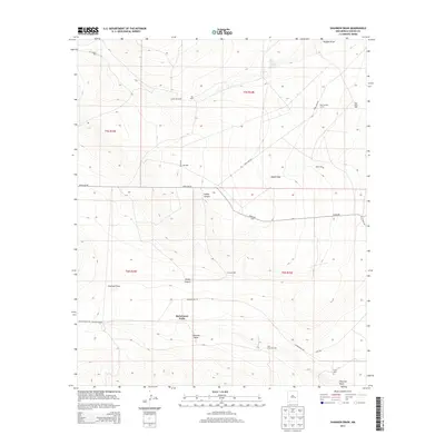
2013 Map of Shannon Draw
USGS Topo · Published 2013About this map
McDermott Wells and the surrounding high desert of Chaves County are defined by a sparse but vital network of water sources and ranching infrastructure. This survey captures the landscape of southeastern New Mexico, where deep-cut features like Shannon Draw and Hobbs Canyon dominate the topography. The map illustrates the survival strategies of the region, anchored by the Fivemile Ranch and a series of named water points including Costel Windmill, East Fivemile Well, and Blue Water Well. These isolated locations, often connected by long-established routes such as Dona Ana Rd and Cottonwood Rd, provided the essential nodes for cattle ranching. The presence of Rock House Springs and various corrals like the East Stancel Corral highlights the historical reliance on both natural springs and engineered wells to sustain life in this arid environment.
Find a feature on this map
28 named features on this map. Tap any name to fly to it.
Don’t see what you’re looking for? This feature index may not catch every label — zoom into the map to look around manually.
Map Details
Editions of this 2013 Shannon Draw Map
This is the sole edition of this map. No revisions or reprints were ever made.
Other maps of this area

1955 · Roswell
USGS Topo · 1:250,000

1958 · Roswell
USGS Topo · 1:250,000

1962 · Roswell
USGS Topo · 1:250,000

1962 · Eightmile Draw
USGS Topo · 1:24,000

1962 · Marley Draw
USGS Topo · 1:24,000

1963 · Coyote Draw
USGS Topo · 1:24,000

1967 · Deering Place
USGS Topo · 1:24,000

1967 · Cottonwood Draw
USGS Topo · 1:24,000

1967 · Dunlap Sill
USGS Topo · 1:24,000

1967 · Swallow Nest Canyon
USGS Topo · 1:24,000