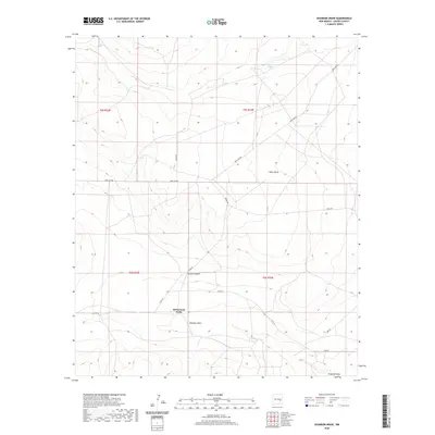
2020 Map of Shannon Draw
USGS Topo · Published 2020About this map
McDermott Wells sits at a junction of early-21st-century cattle-range infrastructure within the high plains of Chaves County. This landscape is defined by its drainage patterns and water access points, including the seasonal watercourse of Shannon Draw and the more localized Rock House Springs to the north. The survey reveals a sparse network of county and ranch roads, such as Dona Ana Rd and Ramah Rd, which cross the terrain to connect remote outposts. Further south, the topography transitions toward Fivemile Draw, illustrating the characteristic wash-and-canyon system that dictates movement through this arid region. The map provides a clear look at the intersection of public land survey sections and ranching routes, anchoring local geography at the head of Hobbs Canyon.
Find a feature on this map
18 named features on this map. Tap any name to fly to it.
Don’t see what you’re looking for? This feature index may not catch every label — zoom into the map to look around manually.
Map Details
Editions of this 2020 Shannon Draw Map
This is the sole edition of this map. No revisions or reprints were ever made.
Other maps of this area

1955 · Roswell
USGS Topo · 1:250,000

1958 · Roswell
USGS Topo · 1:250,000

1962 · Roswell
USGS Topo · 1:250,000

1962 · Eightmile Draw
USGS Topo · 1:24,000

1962 · Marley Draw
USGS Topo · 1:24,000

1963 · Coyote Draw
USGS Topo · 1:24,000

1967 · Deering Place
USGS Topo · 1:24,000

1967 · Cottonwood Draw
USGS Topo · 1:24,000

1967 · Dunlap Sill
USGS Topo · 1:24,000

1967 · Swallow Nest Canyon
USGS Topo · 1:24,000